


This tool generates a layer containing the network segments representing a given distance (cost) from some source. The calculation takes into account the flow direction defined by the topology of the network layer.
To use this utility first load a line layer with a network topology. If the network topology has already been created for the line layer then select the Load topology from previously generated network option from the Network menu, otherwise select Network|Generate network topology to create the topology.
Also load a point layer representing origin points into the ToC. Finally, open the Route control panel (Network|Manage stops) and add stops by clicking the Load stops button.
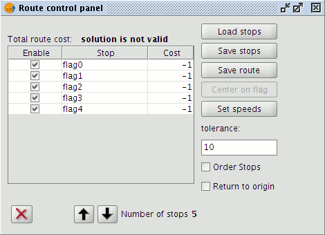
Route control panel for managing stops
To calculate the minimum spanning tree for the active layer in the ToC select Minimum Spanning Tree from the Network menu.
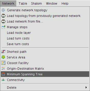
Minimum Spanning Tree option on the Network Menu
In the window that appears enter the cost (i.e. the distance in metres) for determining the coverage of segments from each stop.
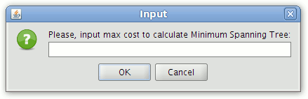
Input form for entering the cost
After pressing the Ok button the resulting tree is automatically added to the ToC as a temporary line layer. The colour and width of the lines can be changed by accessing the Layer Properties.
Open the attribute table of this layer to see the fields that have been generated. The start and end of each segment of the tree has an associated cumulative cost from the stop, i.e. the cost represents the distance travelled, in metres, from the stop in question.
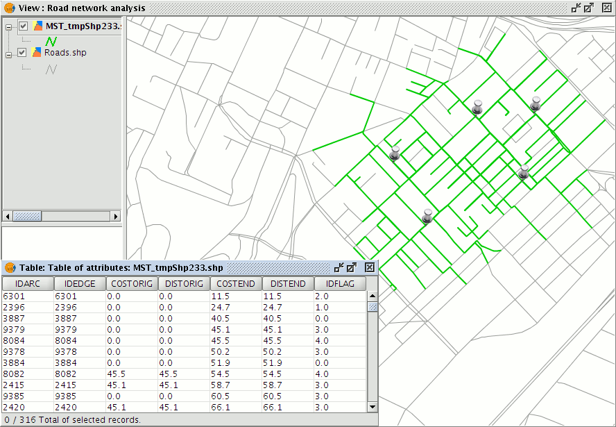
Graphical and tabular results of the Minimum Spanning Tree calculation
The layer can be saved in any of the allowable formats (shp, dxf, postgis, gml) using the Layer|Export to ... command. This exports the entire layer and not just the segments for particular stops. To export segments corresponding to a specific stop first select the appropriate segments by making use of the values in the IDFLAG attribute field.
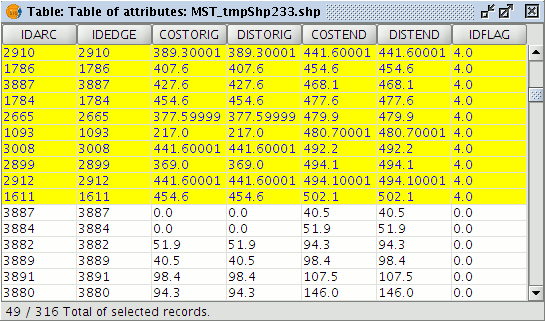
Attribute table of the calculated tree, showing selected records associated with a particular stop
This will export only the section of the tree corresponding to that stop.


